Self-Guided Hike to the top of Qorre Mountain
– Conquer Mount Qorre (2018m), one of the highest peaks along Albania’s Ionian coast.
– Begin in the pine forests of Llogara and rise into a world of cliffs, cirques, and rocky ridgelines.
– Traverse scree slopes and reach a summit where sea, sky, and stone converge in a 360° panorama.
– A physically demanding but non-technical summit for experienced hikers
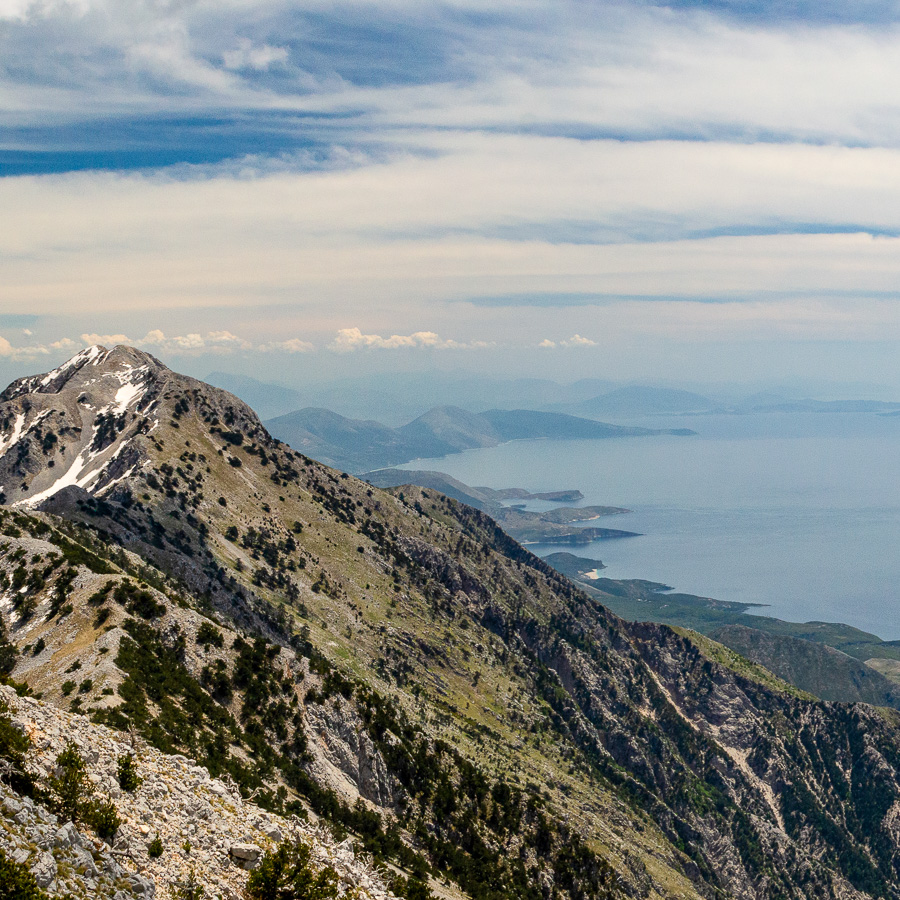
Rising to 2018 meters, Qorre is one of the highest and most striking peaks in the Ceraunian Mountain Range. This range stretches dramatically along the Albanian Riviera, dividing the turquoise Ionian coast from the inland valleys. The western flanks are cloaked in the dense pine forests of Llogara National Park, while the upper reaches give way to alpine scree, glacial cirques, and barren cliffs that plunge toward the sea. On a clear day, the summit reveals a breathtaking panorama that sweeps across the Ionian coastline. The contrast of lush woodland, rugged rock, and endless blue creates one of Albania’s most awe-inspiring landscapes.
The hike begins at the Llogara Pass, already perched at 1020 meters above sea level. From here, the trail quickly ascends into pine forest, offering a shaded and fragrant start. As you gain elevation, the trees begin to thin, revealing the raw and rocky slopes above. The trail becomes steeper and transitions into scree fields, loose rock and gravel that require careful footing. The path is marked and clear throughout, steadily zigzagging up toward the imposing summit of Qorre. Once at the top, a wide, wind-swept plateau opens up, where you can pause and absorb a 360-degree view of sea, sky, and mountains. After taking in the vistas, you’ll retrace your steps along the same trail to descend back to the pass.
- Hike’s difficulty: 3/5
- Total ascent: 1000 m
- Total descent 1000 m
- Distance: 8 km
- Time of the hike: 5 hours (Hiking time without breaks)
| The price includes: |
|
|
| The price does not include: |
|
|
|
|
|
This trail starts and ends at the trailhead at the Llogara Pass. You have to drive to the starting point of the hike yourself. Free and paid parking is available nearby.
| Orientation: |
| To assist you, we provide a detailed information package, including route descriptions, digital maps and information about transportation options. All this will be available in a dedicated mobile app, which you can download to your smartphone before your adventure.
|
| While most hiking trails are signed, some markings may be unclear or difficult to see. Certain sections might not be well-marked, and poor weather can make navigation more challenging. Good navigation skills are necessary to ensure a safe and enjoyable experience.
|
| General Information: |
|
|
|
|
|
|
| Free cancellation at any time before app download. Once the app has been downloaded, cancellations are no longer possible. |