Self-Guided Hike to “Kunji i Rragamit” in Valbona
– Reach one of Valbonë’s most stunning, but lesser-known, viewpoints at 1,868 meters
– Enjoy a consistent, shady ascent through dense beech forest: perfect for summer
– Reach an alpine summit where the landscape suddenly opens in all directions
– Self-guided and off the tourist map: perfect for those who hike to disconnect
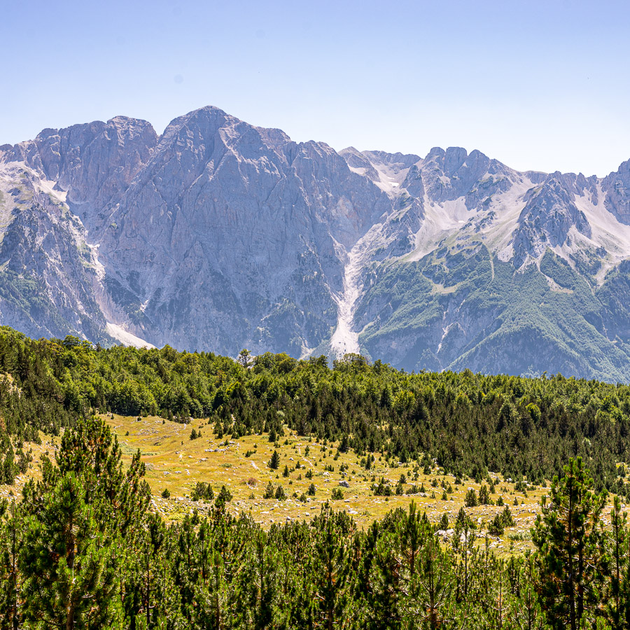
Rising above the western slopes of the Valbona Valley, this lesser-known summit offers some of the most expansive panoramic views in the region. At 1868 meters above sea level, the viewpoint reveals the entire Valbonë basin below, framed by the jagged limestone peaks of the Accursed Mountains and the open alpine landscapes of the Valbonë Valley National Park. Despite its impressive outlook, the trail is relatively quiet and off the main tourist path, making it a rewarding option for hikers seeking both solitude and scenery.
The hike begins from the center of the village, where you’ll quickly leave the open valley floor and head into dense beech forest. The trail climbs steadily from the beginning, offering natural shade and cooler temperatures even during the warmer months.
As the route ascends, the path winds through thick woodland and makes a series of switchbacks across the western slopes of the valley. The forest cover is consistent for most of the climb, with occasional breaks offering glimpses through the trees toward the valley below. The trail is clear and well-trodden, but the incline remains constant, requiring moderate fitness.
In the final part of the ascent, the terrain opens up. The trees give way to a wide alpine meadow that leads toward the summit ridge. This final section is steeper and more exposed but offers dramatic views in all directions. Upon reaching the summit, you’re rewarded with a sweeping view of the Valbonë Valley.
After a well-earned rest and time to take in the scenery, the return follows the same route downhill, retracing the forest trail back into the village.
- Hike’s difficulty: 2/5
- Total ascent: 900 m
- Total descent 900 m
- Distance: 18 km
- Time of the hike: 6 hours (Hiking time without breaks)
| The price includes: |
|
|
| The price does not include: |
|
|
|
|
|
This trail starts and ends in the village of Valbona in the Albanian Alps.
| Orientation: |
| To assist you, we provide a detailed information package, including route descriptions, digital maps and information about transportation options. All this will be available in a dedicated mobile app, which you can download to your smartphone before your adventure.
|
| While most hiking trails are signed, some markings may be unclear or difficult to see. Certain sections might not be well-marked, and poor weather can make navigation more challenging. Good navigation skills are necessary to ensure a safe and enjoyable experience.
|
| General Information: |
|
|
|
|
|
|
| Free cancellation at any time before app download. Once the app has been downloaded, cancellations are no longer possible. |