Half-Day Self-Guided Hike to the Berizhdoli Peak in Lëpushë
– Hike from the peaceful village of Lëpushë through wild meadows and forested slopes.
– Climb to Berizhdoli Pass and summit: where sweeping views stretch deep into the Accursed Mountains.
– Follow historic shepherd paths with a blend of forest, streamside, and ridge terrain.
– Experience a self-guided route that feels remote, authentic, and beautifully off the radar.
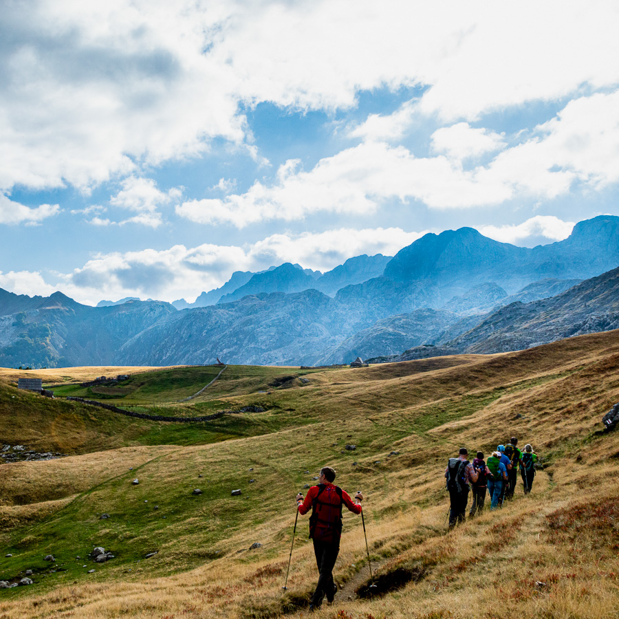
Tucked into the rolling landscapes of the Kelmend region, the village of Lëpushë sits at 1200 meters in a peaceful valley. The area is the perfect starting point for different hikes with its diverse natural features: wide grassy pastures, dense beech and pine forests, and rugged limestone peaks. In spring and summer, the meadows bloom with wildflowers, while the upper ridges offer sweeping views deep into the Accursed Mountains. The hike here offers a well-balanced mix of highland wilderness and historic shepherd routes through little-traveled terrain.
The hike begins in the center of Lëpushë and sets off southwards on a marked trail toward Bordoleci Pass. This initial ascent crosses a series of green pastures and forest patches, offering open views back toward the village. The path curves southwest, following the course of the Berizhdoli Stream.
As you ascend, you’ll pass through a narrow alpine pasture occasionally used by shepherds during the summer grazing season. The landscape opens further as the trail reaches the Berizhdoli Pass. From here, the nearby Berizhdoli Peak dominates the view, its ridgeline offering a preview of what’s to come.
From the pass, the route continues along the ridge in a Western direction, until it reaches the summit.
After taking in the views, you will return to the village along the same trail.
- Hike’s difficulty: 3/5
- Total ascent: 600 m
- Total descent 600 m
- Distance: 9 km
- Time of the hike: 4 hours (Hiking time without breaks)
| The price includes: |
|
|
| The price does not include: |
|
|
|
|
|
This trail starts and ends in the village of Lëpushë in the Albanian Alps.
| Orientation: |
| To assist you, we provide a detailed information package, including route descriptions, digital maps and information about transportation options. All this will be available in a dedicated mobile app, which you can download to your smartphone before your adventure.
|
| While most hiking trails are signed, some markings may be unclear or difficult to see. Certain sections might not be well-marked, and poor weather can make navigation more challenging. Good navigation skills are necessary to ensure a safe and enjoyable experience.
|
| General Information: |
|
|
|
|
|
|
| Free cancellation at any time before app download. Once the app has been downloaded, cancellations are no longer possible. |