
Self-Guided hike in Petrela, in the surroundings of Tirana
Self-Guided hike in Petrela, in the surroundings of Tirana
Price From: 999€
Duration: 5 Hours
Minimum Age: 12
Language: English
Category: Hiking
Hiking Grade: Moderate
Technical Difficulty: T2
Tour ID: S-TR-HI-05
– Great for beginners and hikers of all levels
– Hike at your own pace with a digital map in a dedicated mobile app
– Explore rural landscapes away from the hustle and bustle of the city
– Admire the scenic views over the capital city and the Erzeni River Valley
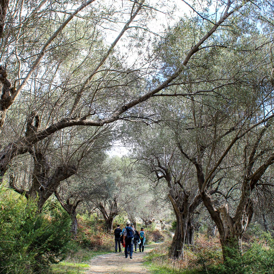
The region where you will hike today lies only few kilometres from Tirana. The hike is not difficult. The trail is signed, visible and winds through rural landscapes and archaeological ruins, that make the path even more interesting.
The hike starts from the central square of the village of Petrela.
You will travel there on your own. If you have a car, just follow the asphalted road that brings you right there. There is public transportation that brings you right at the starting point of the hike.
You will follow a disused gravel road that leads at first to the ancient settlement of Persqop, built in the 4th century BC. The trail continues, to the vicinity of the small village of Durisht, from where it starts ascending the mountain with the same name. The descent follows in the direction of the monumental tomb of Persqop and from there back to the starting point in Petrela village.
- Hike’s difficulty: 2/5
- Total ascent: 600 m
- Total descent 600 m
- Distance: 13 km
- Time of the hike: 5 hours (Hiking time without breaks)
The price includes:
- Emergency telephone support during the hike
- Road Book App with detailed information and route descriptions in English
The price does not include:
- Other costs and services not mentioned in the program
- Guide
- Meals
- Transportation
- Any type of Insurance
This trail starts and ends in Petrelë. You have to drive to the starting point of the hike yourself or take public transport. Parking is available nearby.
Orientation:
To assist you, we provide a detailed information package, including route descriptions, digital maps and information about transportation options. All this will be available in a dedicated mobile app, which you can download to your smartphone before your adventure.
While most hiking trails are signed, some markings may be unclear or difficult to see. Certain sections might not be well-marked, and poor weather can make navigation more challenging. Good navigation skills are necessary to ensure a safe and enjoyable experience.
Hiking Time, Grade and Technical Difficulty:
Our tour descriptions give detailed information about terrain, technical difficulty, estimated activity times, ascent/descent in meters and distance in kilometres. We kindly ask you to read these very carefully and consider them while choosing your tour.
The estimated difficulty of hikes is given in the SAC scale, starting from T1 to T6. These grades are guidelines that must always be used in conjunction with your own experience, intuition and careful judgment. Explanations for the difficulty scale can be found here.
Estimated hiking times are given for each day. These times do vary according to the day’s weather conditions and your fitness levels. These times do not include times taken for meals and breaks. The hiking times are all calculated in accordance with the Albanian national standard for hiking trails, which is based on the Swiss Alpine Club adaptation of the DIN44366 standard.
Meals:
During this hike, there is no possibility to stop at a restaurant for a meal. You will need to provide your own packed lunch.
General Information:
- Confirmation will be sent within 48 hours of booking
- Not wheelchair or stroller accessible
- Not recommended for pregnant travellers
- Not recommended for travellers with heart problems or other serious medical conditions
- Travelers should have a moderate physical fitness level
- For any other request or question, please write to us here
Free cancellation at any time before app download. Once the app has been downloaded, cancellations are no longer possible.