Self-Guided Hike to Mt. Greben from Lëpushë
– Ascend Maja e Grebenit from Lëpushë for panoramic views over two valleys and two countries
– Hike a quiet ridge route through pastures, light forests, and wide-open alpine terrain
– Spot the jagged skyline of the Accursed Mountains as you ascend
– Enjoy a steady, non-technical trail that leads directly to the summit
– A self-guided hike designed for those who love silence and pristine nature
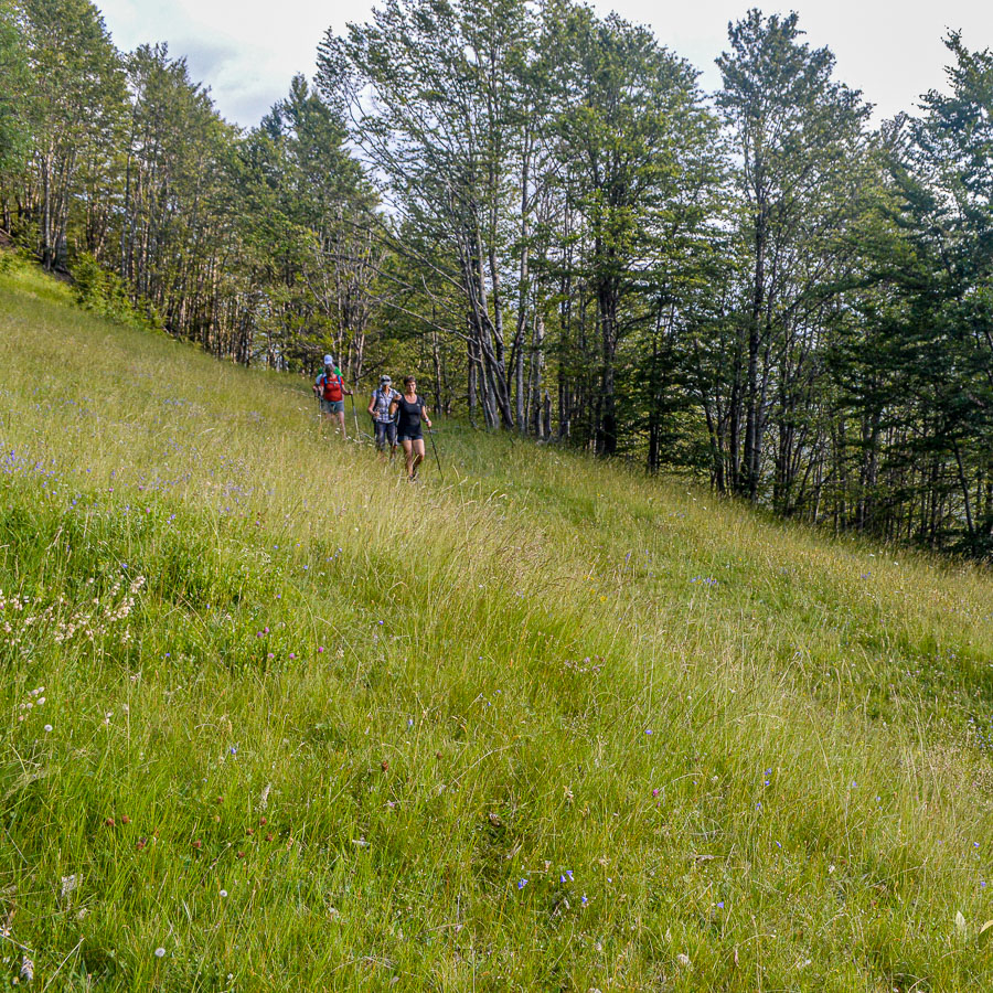
Maja e Grebenit is a prominent peak that marks the border between the valleys of Lëpushë and Vermosh, offering wide views over alpine terrain. This hike reveals open ridges, patches of alpine forest, and an increasingly panoramic horizon as you gain elevation. It’s a quiet approach through one of the greenest sections of the Kelmend region: not steep but still offering a strong sense of elevation and reward.
The hike begins from Lëpushë and immediately climbs northwest along a clear trail that cuts across the mountain’s lower slopes. The path passes through a mix of pastureland and light forest, offering partial shade and scattered views toward the valley below.
As the trail gains elevation, the terrain opens and the forest thins. The route becomes more panoramic, with the jagged ridges of the Accursed Mountains appearing to the south and southwest. The trail remains non-technical and gradually steepens, winding toward the high saddle that leads to the summit ridge.
Once at the ridge, the summit of Maja e Grebenit becomes clearly visible. A short final climb leads to the top, where you’ll be rewarded with sweeping views over the Vermosh Valley, the green slopes of Lëpushë, and the borderlands of Montenegro.
After taking in the view, the return follows the same path, descending gently back to the village.
- Hiking Grade: Moderate
- Technical Difficulty: T2
- Total ascent: 500 m
- Total descent 500 m
- Distance: 9 km
- Time of the hike: 3 hours (Hiking time without breaks)
The price includes:
- Emergency telephone support during the hike
- Road Book App with detailed information and route descriptions in English
The price does not include:
- Other costs and services not mentioned in the program
- Guide
- Meals
- Transportation
- Any type of Insurance
This trail starts and ends in the village of Lëpushë in the Albanian Alps.
Orientation:
To assist you, we provide a detailed information package, including route descriptions, digital maps and information about transportation options. All this will be available in a dedicated mobile app, which you can download to your smartphone before your adventure.
While most hiking trails are signed, some markings may be unclear or difficult to see. Certain sections might not be well-marked, and poor weather can make navigation more challenging. Good navigation skills are necessary to ensure a safe and enjoyable experience.
Hiking Time, Grade and Technical Difficulty:
Our tour descriptions give detailed information about terrain, technical difficulty, estimated activity times, ascent/descent in meters and distance in kilometres. We kindly ask you to read these very carefully and consider them while choosing your tour.
The estimated difficulty of hikes is given in the SAC scale, starting from T1 to T6. These grades are guidelines that must always be used in conjunction with your own experience, intuition and careful judgment. Explanations for the difficulty scale can be found here.
Estimated hiking times are given for each day. These times do vary according to the day’s weather conditions and your fitness levels. These times do not include times taken for meals and breaks. The hiking times are all calculated in accordance with the Albanian national standard for hiking trails, which is based on the Swiss Alpine Club adaptation of the DIN44366 standard.
General Information:
- Confirmation will be sent within 48 hours of booking
- Not wheelchair or stroller accessible
- Not recommended for pregnant travellers
- Not recommended for travellers with heart problems or other serious medical conditions
- Travelers should have a moderate physical fitness level
- For any other request or question, please write to us here
Free cancellation at any time before app download. Once the app has been downloaded, cancellations are no longer possible.